The Orchards of Lanark So Fair
An archaeology of fruit
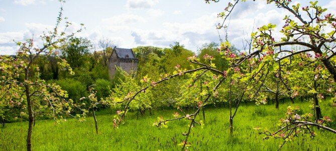
The sheltered slopes of the Clyde and Avon Valley, with their well-drained soils and moderate rainfall, are particularly good for fruit growing, and especially for orchards. Their location, not far from some of Scotland’s major cities and towns, was also an important factor in their development, particularly during the period of industrial growth in the 19th century. More than a source of income and food however, fruit became an important component of the areas cultural heritage providing inspiration for songs, stories and art for generations.
Fruit growing has had a long history in the Clyde and Avon Valley, with written sources suggesting that the monks at Lesmahagow priory tended apple and pear orchards during the middle ages. In the 17th century, maps produced of the area depict the regions produce for the first time. For instance Blaeu's map of 1654 (see link on right) has fruit in the heraldic device for Clydesdale, while Slezer's 1693 engraving of Hamilton (see link on right) depicts well tended orchards in a managed landscape.

Today’s landscape is largely a product of its management and subsequent decline in the 19th and 20th centuries. It is now a landscape of gardens centres, farming and forestry and only fragments of the country estates, gardens and orchards survive.
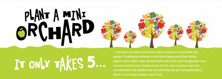
One local group, Clyde Valley Orchards Cooperative Limited, is trying to reverse this decline with the aim of preserving this important element of the historic environment. The orchards provide an important bank of fruit and knowledge at a time when local produce and variety is starting to be valued in new contexts. The vision of the Orchard Cooperative is to restore and develop the orchards and their associated enterprises as a key asset of the Clyde Valley to benefit the community, local economy, landscape and wildlife. Working alongside the Clyde and Avon Valley Landscape Partnership, over 1000 new fruit trees will have been planted by 2018 in new and existing orchards while the Cooperative's fruit juice now provides a revenue stream for sustainable management and development of the orchards. As part of this work CAVLP Heritage volunteers have been exploring the archaeology of the orchards.
Mapping evidence of the orchards allows us to see how the landscape has changed over time. On William Roy’s (1747-55) map it is possible to distinguish natural woodland from orchards, plantations and tree lined avenues, for instance around the Dalzell Estate. However it was not until the production of the Ordnance Survey maps that the orchards were first mapped in detail.
GIS analysis of Ordnance Surveys maps by CAVLP Heritage volunteers have demonstrated the changing spread of orchards from the 1860’s to the 1950s. As can be seen in the graph and maps below the orchards once covered a huge area of the Clyde and Avon Valleys.
From 1860’s to the 1890’s there was a significant increase in the spread and distribution of the orchards, representing increased demand from the major urban areas of Glasgow and the Central Belt. There was further increase until the 1950’s but by 2004, when the last systematic survey of the orchards took place, we can see a dramatic reduction the spread of the orchards in the area, with only 62Ha of the Clyde and Avon Valley covered by orchards.

By focusing on sites highlighted by the map evidence, a team of Northlight Heritage volunteers have been working to record some of the archaeological remains of the orchards, particularly around the Hazelbank area. One interesting archaeological feature is the water management system. Water management was an important feature of orchard management as apple and plum trees do not like water logged soil, a problem in this part of the world. Growers had to work out ways to get the water off the slopes of the orchards, so that the soil became drier and the trees could grow. Therefore a series of wells, drains and culverts were constructed to manage this water.

While the plum and apple orchards were the main crop, growers also had to diversify by planting soft fruits such as gooseberries as well as nuts around the base of the trees. These fruits would ripen at different points through the year, providing an additional income for the growers. Much of this soft fruit, as well as the apples and plums would be loaded onto trucks from the packing sheds, so that they could be taken to market. The remains of many of these sheds can still be seen dotted across the landscape, but most have been converted for modern use.

Together, these features, along with the original growers houses, as well as the field boundaries, and the relic apple and plum trees themselves form a tapestry of historic land management that has had profound implications on how the landscape around Hazelbank looks today.
By analysing historic maps, recording the archaeological features as well as recording the biocultural heritage of the orchards, we can begin to understand the horticultural industry of the Clyde and Avon Valleys, as well as how this landscape was managed over hundreds of years. Archaeology plays an important part in adding value to the preservation of the orchards, by demonstrating the long term human impact on the landscape and recording the evidence that communities who managed and worked this landscape left behind. By demonstrating how communities in the past worked the land we can help communities today have a deeper understanding about how to manage the landscape, and the orchards, for the future.
This museum item was created by CAVLP Heritage Officer Paul Murtagh, as part of the Capturing the Past project, exploring the working lives of people throughout time in the Clyde and Avon Valley in 2016. The project was managed by Northlight Heritage and supported by Historic Environment Scotland and Heritage Lottery Fund supported Clyde and Avon Valley Landscape Partnership.
Watch the Clyde Valley Orchards feature on BBC Countryfile below.

